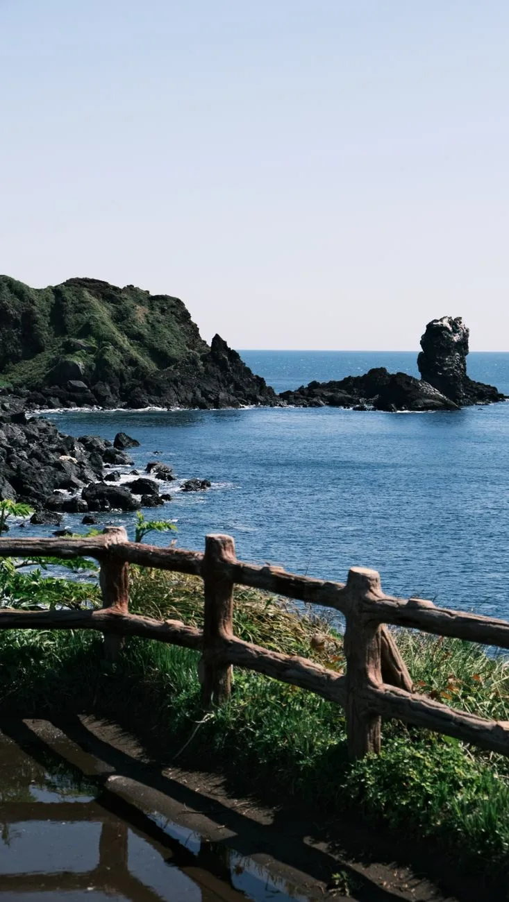
Twenty-seven routes, 437 km, and no official ranking. The Jeju Olle Foundation, which has managed the trail since the first route opened in 2007, has never published a best-route list or per-route walker counts, so the answer has to be built from grade, length, and where each route leaves you at the end.
Route 6 is the best Jeju Olle trail for a first walk: 11.0 km from Soesokkak to the Jeju Olle Tourist Center, 3 to 4 hours, mostly flat and paved, finishing inside downtown Seogwipo at Lee Jung-seop Street and Seogwipo Maeil Olle Market. Want coastline over convenience? Route 7. Want a half day? Route 10-1 on Gapado.
The short version
- Easiest real introduction: Route 6, graded Easy, 11.0 km, ends in the middle of a city with buses, food and the certificate office.
- Best coastline: Route 7, graded Medium, past the 20-metre Oedolgae sea stack and the Hwangwooji tidal pools. Part of it was closed for construction as of May 2026.
- Shortest walkable route: Route 10-1 on Gapado, 4.2 km, graded Easy.
- Hardest for its length: Route 9, only 11.8 km but graded High. Distance and difficulty are not the same axis here.
Why there is no official answer to which Jeju Olle trail is best
The Foundation grades every route Easy, Medium or High and publishes its length, but it ranks nothing. Every "top route" list in circulation is editorial. The closest thing to an official steer is in the trail's own English guidance, which points international walkers at Routes 1, 6, 7 and 18, and describes Route 6 as the best and easiest introduction.
That matters for how you read the rest of this page. Route 6 is not the prettiest route on Jeju. It is the one with the highest chance of a first-time walker finishing, on time, without a car, and with somewhere to eat at the end.
The trail was founded by Suh Myung-sook, a Jeju native and former editor-in-chief of OhmyNews, and it is deliberately not wilderness. Bus stops sit near most route start and end points, which is why a bad decision on Jeju costs you an afternoon rather than a rescue.
Route 6, in detail, and why it wins the first day
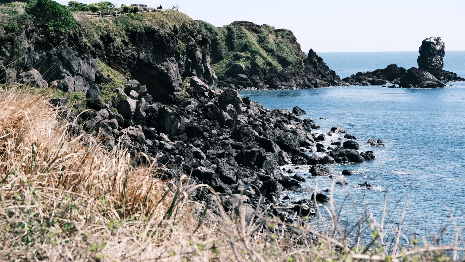
Route 6 starts at Soesokkak, the estuary where a freshwater stream meets the sea under black rock walls, climbs the low Jejigi Oreum, passes the Socheonji rock pool, offers a short detour to Jeongbang Falls, then runs into Seogwipo along Lee Jung-seop Street and through Seogwipo Maeil Olle Market before ending at the Jeju Olle Tourist Center.
Three things make it the sensible opener. It is graded Easy and mostly paved. It finishes downtown, so no return bus is needed. And its first 3.3 km are wheelchair-accessible, the longest accessible stretch on the trail, shown in orange on Kakao Map where the rest of the trail appears as a dotted blue line.
Route 6 also carries the only regular English-language guided walk on the trail: Walking Mate, run by the Jeju Olle Foundation on Saturday mornings in English, Chinese and Japanese.
This fails if you are based in Jeju City without a car. Route 6 sits on the south coast. Crossing the island by bus eats the morning, and at that point Route 18, which starts in downtown Jeju, is the better use of the day.
The four routes the trail's own guidance recommends
This table answers one question: if you only walk one route, which one, and what does it cost you in time? Walking times are calculated at a steady 3.5 km/h, except Route 6, where the published 3 to 4 hours already accounts for stops.
| Route | Distance (km) | Official grade | Walking time (est.) | Pick it for |
|---|---|---|---|---|
| 6 | 11.0 | Easy | 3–4 h | First walk, ends downtown |
| 7 | 17.6 | Medium | 5–6 h | Oedolgae Rock, sea cliffs |
| 1 | 15.1 | Medium | 4–5 h | Oreum farmland, east coast finish |
| 18 | 19.8 | Medium | 5–6 h | Starting from Jeju City |
| 10-1 | 4.2 | Easy | 1–1.5 h | Gapado island half-day |
| 21 | 11.3 | Easy | 3–4 h | Quiet finish at the loop's end |
What the table shows is that the recommended four are not interchangeable. Route 6 is the shortest of them by 4.1 km and the only one graded Easy, and Routes 1, 7 and 18 each demand a full day plus transport at one end.
One warning on Route 7's length: two figures are in circulation, 17.6 km in the route listings and 15.1 km on many walk descriptions of the Oedolgae to Wolpyeong stretch. Plan on the longer number and treat an early finish as a bonus.
Distance is not difficulty on this trail
Route 9 is 11.8 km and graded High. Route 3-A is 20.9 km and also High, while Route 3-B covers the same start and end points in 14.6 km at Easy. The grade tracks climb and surface, not kilometres.
Where a route has an A and B variant, the B option is the softer one:
| Variant | Distance (km) | Official grade |
|---|---|---|
| 3-A Onpyeong–Pyoseon | 20.9 | High |
| 3-B Onpyeong–Pyoseon | 14.6 | Easy |
| 15-A Hallim–Gonae | 16.5 | Medium |
| 15-B Hallim–Gonae | 13.0 | Easy |
The table shows the trade: on Route 3, choosing B saves 6.3 km and drops two grade levels for the same two towns. Walkers who pick a route by the number on a map, without checking whether they are on the A or B line, are the ones who arrive at Pyoseon in the dark.
Five cases where Route 6 is the wrong choice
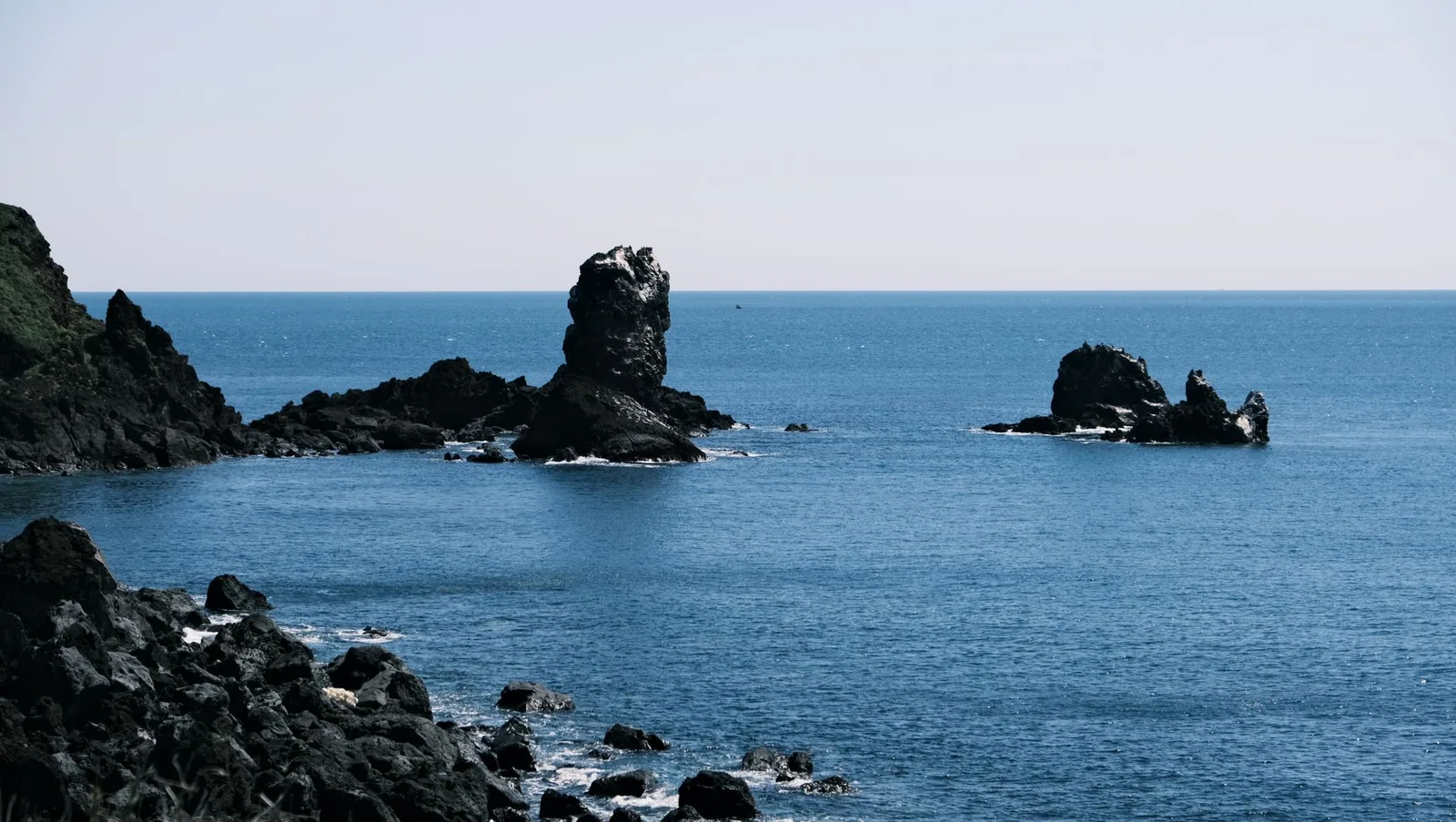
You came for the coast. Route 7 is the one people picture when they picture Jeju: Oedolgae, a 20-metre sea stack standing offshore, then the Hwangwooji tidal pools. Grade Medium, and worth the extra two hours if the weather holds.
You have two hours, not five. Route 10-1 crosses Gapado in 4.2 km at Easy grade. Add ferry time from Moseulpo and it is still a half day.
You want to be tired. Route 9 packs High-grade climbing into 11.8 km, which is the most gradient per hour available on the trail. Route 3-A, at 20.9 km and High, is the long version of the same idea.
You are based in Jeju City. Route 18 starts downtown and runs 19.8 km to Jocheon. Route 21, Hado to Jongdal, is 11.3 km at Easy grade if you want the eastern coast without the distance.
You are here in early November. The Jeju Olle Walking Festival runs 5 to 7 November 2026, 08:00 to 17:00, over Routes 19 and 20, starting at 11-1 Jocheon 18-gil in Jocheon-eup. Entry is ₩30,000 general and ₩25,000 discounted for groups of 20 or more, youth born in 2010 or later, people with disabilities and national merit recipients, with souvenirs and a festival kit included. Pre-registration ran 8 July to 9 October 2026 through the VisitJeju festival listing.
Worked example: one free day in Seogwipo, Route 6 against Route 7
Say you have a single walking day and you are staying in Seogwipo. Jeju's blue city buses and green village buses charge a flat ₩1,200 per trip, so the arithmetic is short.
Route 6. Bus from Seogwipo out to Soesokkak, ₩1,200. Start walking at 09:30. At 3.5 km/h, 11.0 km is 3 hours 8 minutes of moving time. Add the Jeongbang Falls detour and a market stop and you are at the Tourist Center by about 14:00. The route ends downtown, so there is no return fare. Transport for the day: ₩1,200.
Route 7. Same 09:30 start. 17.6 km at 3.5 km/h is 5 hours 2 minutes of moving time, so a photo stop at Oedolgae and 40 minutes for lunch put you at Wolpyeong around 15:45, plus a ₩1,200 bus back into town. Transport for the day: ₩2,400.
The threshold is the clock, not the money. Any day that starts after 10:00, or has to end before 16:00, is a Route 6 day. A full morning with nothing booked afterwards is a Route 7 day. If you are costing a whole Jeju leg rather than one walk, our seven-day Korea trip budget breaks the rest of it down line by line.
Six walking days, 107.9 km, and the stamps that certify it
Walkers with a week often aim at the 100 km certificate rather than the full 437 km loop. One workable set: Routes 6 (11.0), 7 (17.6), 8 (19.6), 3-A (20.9), 4 (19.0) and 18 (19.8). That totals 107.9 km over six walking days, averaging 18.0 km a day, or a little over five hours of walking each day at 3.5 km/h. It needs two or three bases, since Routes 6 to 8 sit around Seogwipo, 3-A and 4 run the southeast coast, and 18 starts in Jeju City.
The money side is small. The paper Olle passport costs ₩20,000, the smartphone app is free to download but Korean-language only with the same ₩20,000 in-app passport, and the completion certificate with its mini medal is ₩5,000 more. Six days of one-way bus trips at ₩1,200 adds ₩7,200. Total for the walking: ₩32,200, excluding food, beds and ferries.
Stamps come from pony-shaped ganse wooden boxes at the start, middle and end of each route. For certification, a passport can be missing up to three mid-point stamps, though every spur route needs its stamps. Certificates are issued on the ground floor of Jeju Olle headquarters in downtown Seogwipo, at 22 Jungjeong-ro, tel. 064-762-2190.
Direction matters for the arrows: blue arrows point clockwise, orange arrows counter-clockwise. Walking against your intended direction and following the wrong colour is the most common way to lose an hour.
When to walk, and the weeks to skip
The trail's official English guidance is blunt about summer: avoid late June through August because of extreme heat. The numbers support it. Jeju's July maximum averages 29.8 °C, August is the wettest month at 263 mm, and the island takes 1,452 mm of rain a year. Seogwipo, where Routes 6 to 8 run, averages 16.2 °C annually and sits about 0.5 to 1.5 °C cooler than Jeju City in summer, which is not enough to save an August afternoon.
The rainy season lands squarely in that window. Korea Meteorological Administration forecasts reported in May 2026 put jangma onset at 30 June 2026 in Jeju, one of the latest starts since nationwide observation began in 1973, with an expected end around 20 July 2026. The 1991 to 2020 average for Jeju is 19 June to 20 July.
October and November, then April and May, are the walking months, with national October daytime temperatures running 10 to 18 °C. If you are combining the island with a wider regional trip, how Korea's and Japan's seasons line up is the timing question worth settling first.
Two other cautions from the official guidance: ticks in high grass, and the presence of pet dogs and occasional wild boar along farmland sections. Long trousers on the overgrown stretches are cheap insurance.
Check closures before you set out
As of May 2026, the section from the Daeryun-dong Community Service Center to Wolpyeong on Route 7 was closed for construction with no announced reopening, with walkers detoured via World Cup-ro and then Iljuseo-ro. Route 7-1, 15.7 km from Seogwipo Terminal to the Tourist Center, is the clean alternative. A section of the Songaksan trail near Route 10 was also closed through 31 July 2026. Live notices go up on the Jeju Olle Foundation's official trail page.
This is general travel information rather than personal advice, and an open coastal trail changes: construction, tides and weather are all live variables on the day you walk.
Questions walkers ask before day one
Which Jeju Olle route is the easiest?
Route 10-1 on Gapado, at 4.2 km and graded Easy, is the shortest. Among routes on the main island, Route 6 (11.0 km) and Route 21 (11.3 km) are both graded Easy and both take 3 to 4 hours.
How long does one Olle route take?
Most routes take 4 to 6 hours at a comfortable pace, with an average length of about 16 km across the 21 main routes and 6 sub-routes.
Do you need the Olle passport to walk the trail?
No. The trail is free and open. The ₩20,000 passport exists only to collect the ganse-box stamps, which are what qualify you for the ₩5,000 completion certificate and medal.
Is Route 6 wheelchair accessible?
The first 3.3 km from Soesokkak are accessible, and Kakao Map marks accessible sections in orange. The remainder of the route includes the Jejigi Oreum climb and is not.
Can you walk the Olle Trail alone?
Yes, and most routes pass through farmland and villages with bus stops near the start and end points rather than remote terrain. The Foundation's free Walking Mate programme on Route 6 every Saturday morning is the low-commitment way to start in company. If you are pricing a solo Korea trip more broadly, what travelling alone adds to the budget covers the single-supplement side.
Which route has the Oedolgae rock?
Route 7. The sea stack stands 20 metres offshore and sits early in the walk out of Seogwipo, before the Hwangwooji coast tidal pools. Check the current detour status first, since the Wolpyeong end of the route was under construction as of May 2026.